DESIGN SENIOR CAPSTONE
HOW MIGHT MAPPING AND WAYFINDING SYSTEMS FOR THE NEW ORLEANS STREETCARS BE INTUITIVE AND BOOST RIDER CONFIDENCE?
Public transit is only effective when it is understandable. A system can be expansive and well-connected, but if riders cannot easily interpret how to use it, what’s the value in that?
Digestible wayfinding can reduce the cognitive effort required to navigate, allowing riders to make quick, confident decisions without prior knowledge of the system. Read more about this here.
When information is visible, consistent, and easy to interpret, it expands the range of people who can use the transit system.
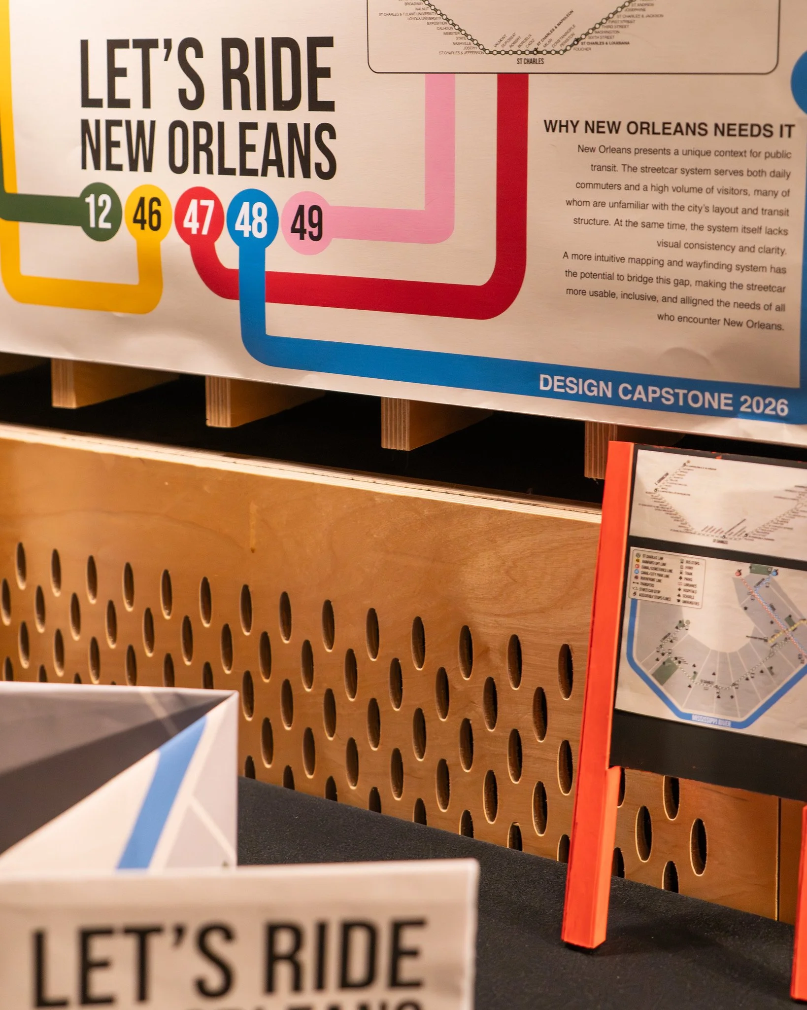
New Orleans presents a unique context for public transit. The streetcar system serves both daily commuters and a high volume of visitors, many of whom are unfamiliar with the city’s transit layout.
At the same time, the current system itself lacks visual consistency and clarity. A more intuitive mapping and wayfinding system has the potential to bridge this gap, making the streetcar more usable and inclusive, and aligning the needs of all who encounter New Orleans.

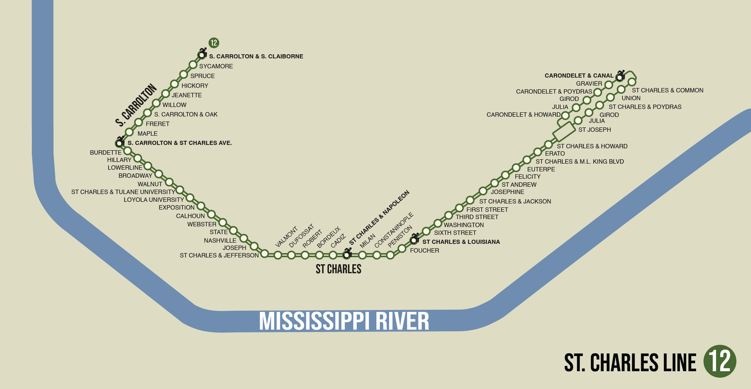
Focusing on the St. Charles streetcar line highlights how gaps in accessibility shape the way people experience transit. While the line is widely recognized and heavily used, its limited accessibility creates uneven access to the system.
IT IS THE ONLY STREETCAR LINE THAT IS NOT 100% WHEELCHAIR ACCESSIBLE.
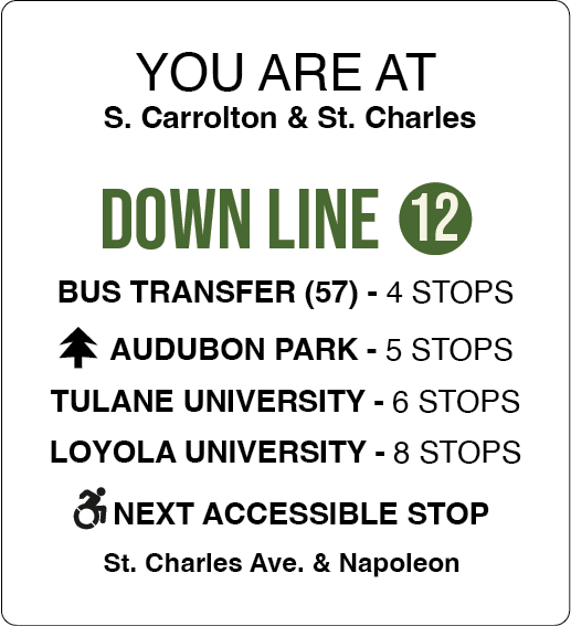
This project approaches accessibility not only as a physical condition, but as an informational one. When accessible stops are clearly marked and easy to understand, riders are able to plan, navigate, and move through the system with greater confidence.
Interested in the current state of New Orleans RTA accessibility for riders? Read more here.
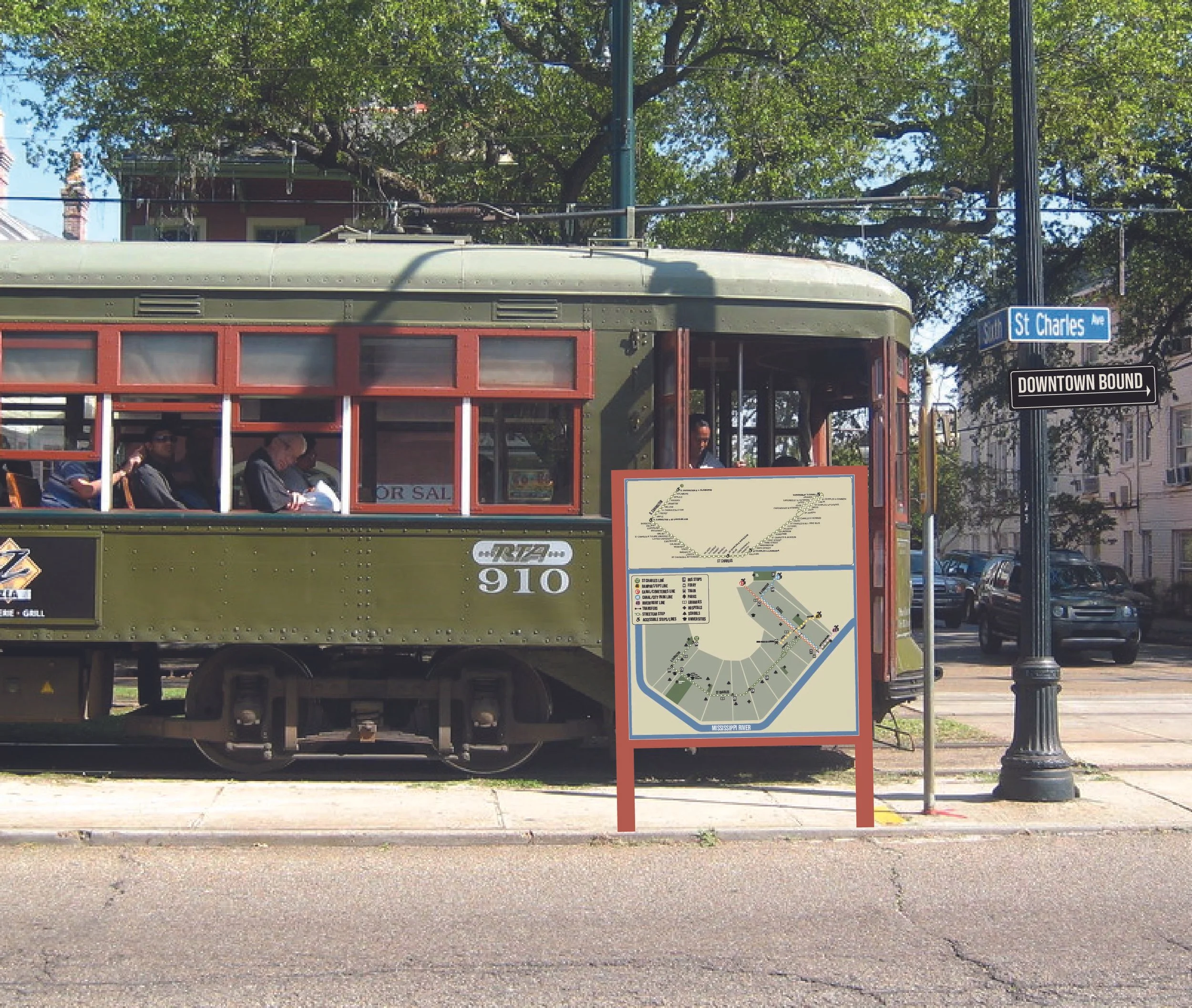
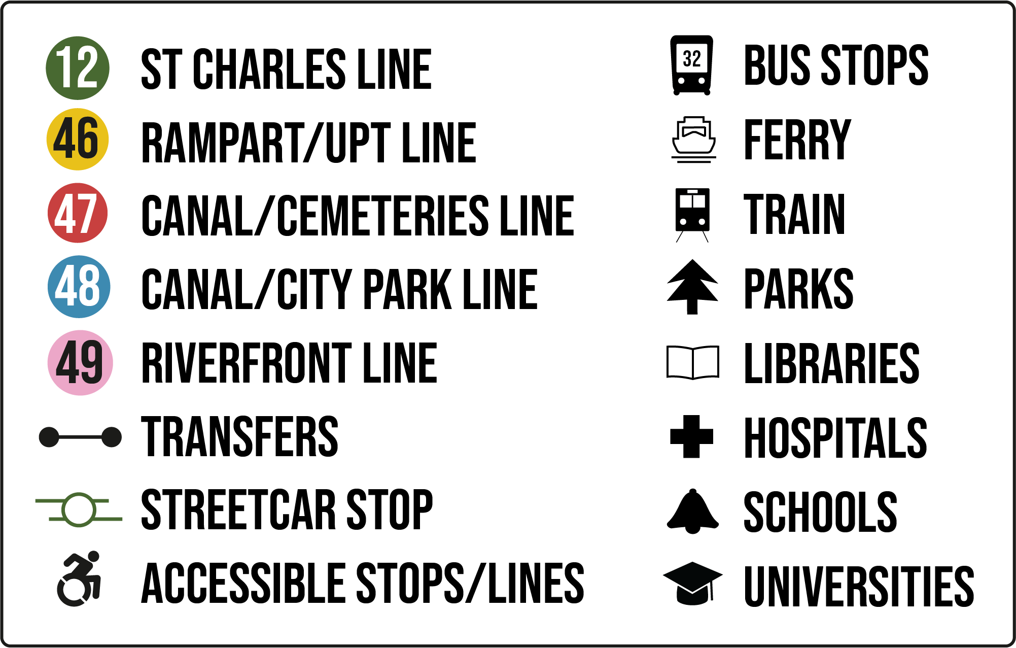
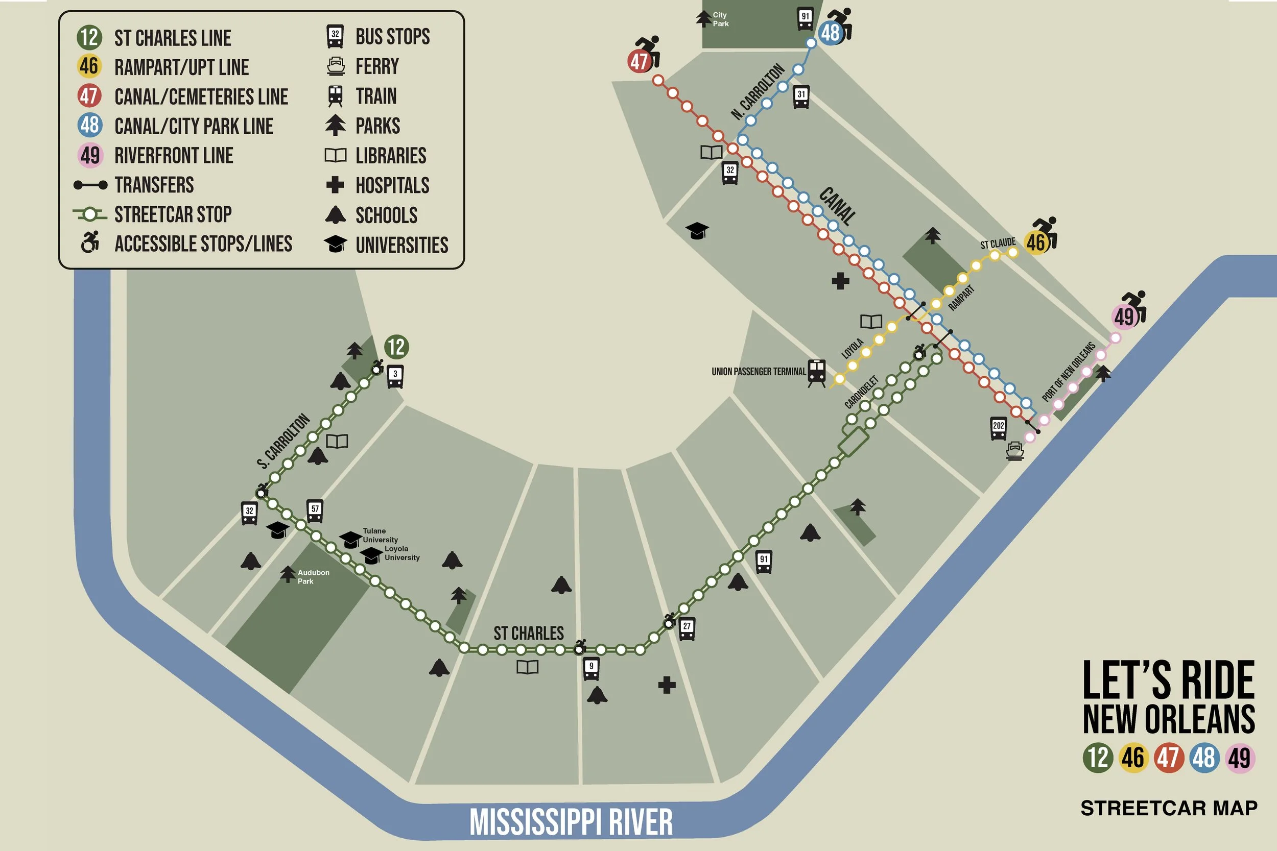
What my redesign is working to accomplish:
True North Orientation: This alignment restores spatial logic.
Accessibility Visibility: Reduces uncertainty for riders with mobility needs.
Color-coded Car Lines: Assigning distinct colors to each line creates immediate visual differentiation.
Highlighting Nearby “Third Spaces” & Transfers: Emphasizing civic and cultural destinations reframes the map around user experience.

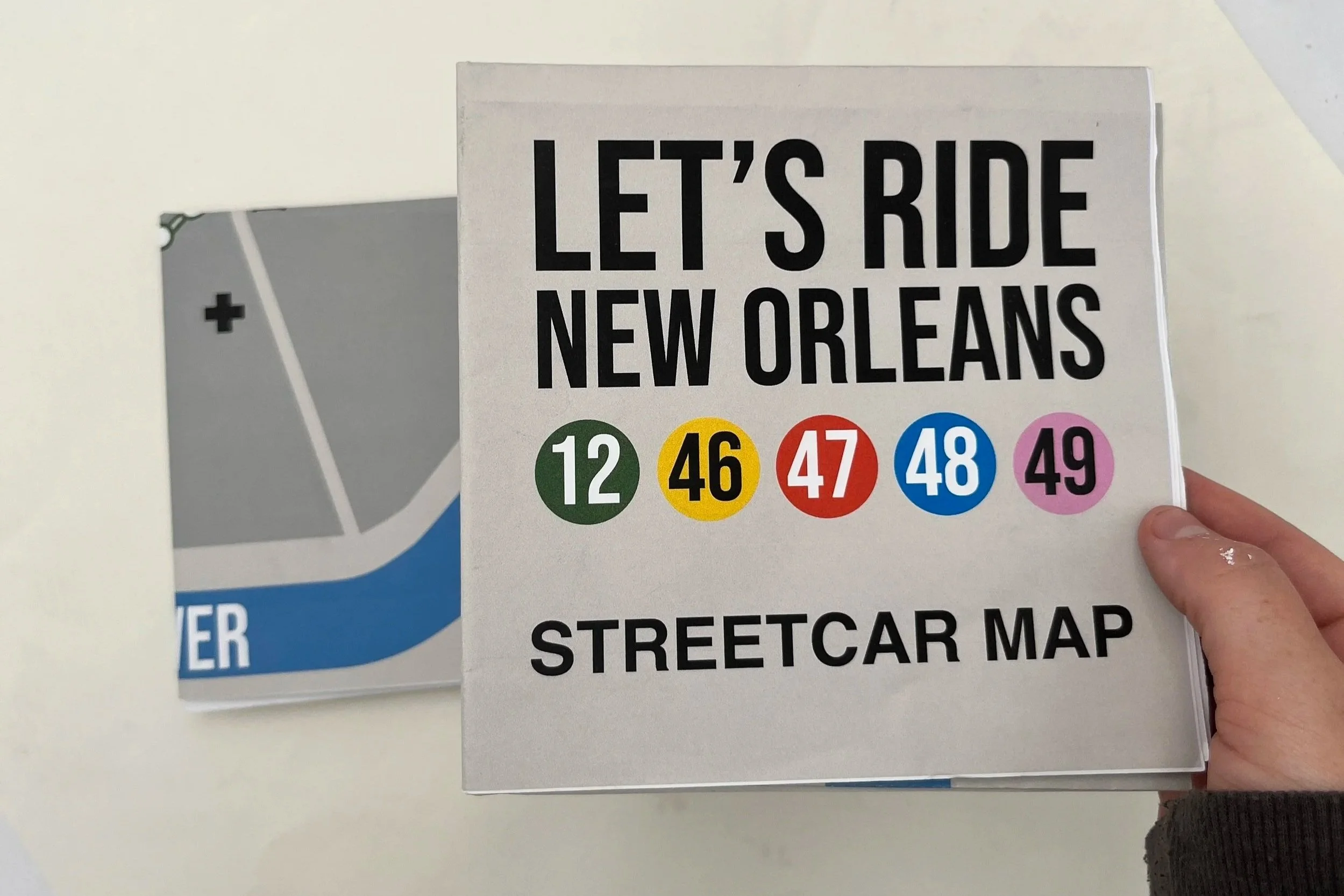

***THIS IS AN ONGOING PROJECT THAT I WILL CONTINUE TO BUILD! PUBLIC TRANSIT IN NEW ORLEANS MUST BECOME MORE ACCESSIBLE.***